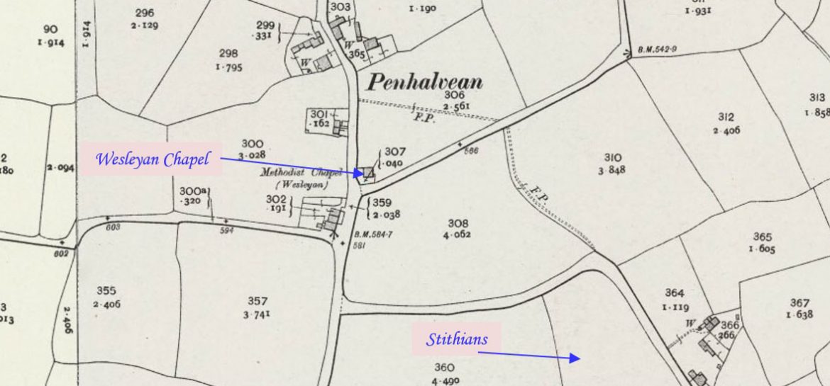
Chacewater is a village approximately 3 miles (4.8 km) east of Redruth. This profile of Chacewater Salem United Methodist Free Church Chapel has been compiled by Jo Lewis and Tony Mansell.   From Wheal Busy drop down to Salem, joining the main Chacewater road, turning left towards Chacewater. As you come down the hill, you…Continue Reading “Mapping Methodism – Chacewater Salem Primitive Methodist / United Methodist Free Church”

Chacewater is a village situated approximately 3 miles (4.8 km) east of Redruth. This profile of the Wesleyan Chapel on Kerley Hill has been compiled by Jo Lewis and Tony Mansell.   A Wesleyan Methodist chapel is recorded at this location to the east of Chacewater near Kerley Paddock on the 1st Edition 1:2500 1880…Continue Reading “Mapping Methodism – Wesleyan Chapel (Kerley Hill), Chacewater”

Creegbrawse is a hamlet in west Cornwall, England, United Kingdom. It is situated between the villages of Chacewater and Todpool approximately three miles east of Redruth. This profile of Creegbrawse Primitive Methodist Chapel has been profiled by Jo Lewis and Tony Mansell.   From Cox Hill (High Street), take the turn to Creegbrawse, the chapel…Continue Reading “Mapping Methodism – Creegbrawse Primitive Methodist Chapel”

Gweek is a village approximately three miles (5 km) east of Helston. This profile of Gweek Wesleyan Chapel was compiled by Jo Lewis and Tony Mansell.   First Chapel Coming into Gweek on Chapel Hill the Wesleyan chapel was on the left before the centre of the village. Unknown build date. 1884: Gweek Chapel mentioned….Continue Reading “Mapping Methodism – Gweek Wesleyan Chapel”

This profile of Parade Street United Methodist Free Church, Penzance, has been compiled by Suzanne Trythall.   1851: foundation stone laid of original chapel to be built by J&J Perkins on the site of a former garden in Parade Street 1857: original chapel opened with a gallery being added later 1861: chapel was enlarged 1871:…Continue Reading “Mapping Methodism – Parade Street United Methodist Free Church, Penzance”

Flushing is a coastal village three miles (5 km) east of Penryn and 10 miles (16 km) south of Truro. It faces Falmouth across the Penryn River, an arm of the Carrick Roads. This profile of Flushing Wesleyan Chapel, Kersey Street / High Street, has been compiled by Jo Lewis and Tony Mansell.   Wesleyan…Continue Reading “Mapping Methodism – Flushing Wesleyan Chapel”