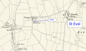
Map: https://maps.nls.uk/geo/explore/side-by-side/#zoom=10.4&lat=52.44811&lon=-3.07812&layers=6&right=ESRIWorld This profile of Tregona Chapel has been compiled by Jo Lewis and Tony Mansell. Located north-west of St Eval Church. Travel east from Engollan on the road opposite the turn to the Candle Co. (old sign if still there says Tregona Chapel Art Exhibition). Follow the road round a 90-degree bend and the…Continue Reading “Mapping Methodism – Tregona Wesleyan Methodist Association (probably) Chapel”
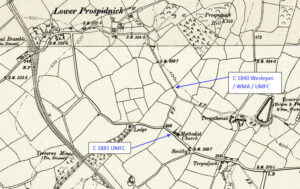
Map: https://maps.nls.uk/geo/explore/side-by-side/#zoom=10.4&lat=52.44811&lon=-3.07812&layers=6&right=ESRIWorld This profile of Tregathenan Chapel has been profiled by Jo Lewis and Tony Mansell. Tregathenan Wesleyan Chapel Pre-1840: The chapel was built by Mr. Reed of Tregathenan, grandfather of the present Mrs Glasson, of Truthall, who gave it to the Wesleyan denomination (See 1881 report below). Heritage Gateway notes that it is…Continue Reading “Mapping Methodism – Tregathenan Wesleyan / United Methodist Free Church”
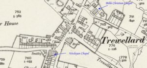
Map: https://maps.nls.uk/geo/explore/side-by-side/#zoom=10.4&lat=52.44811&lon=-3.07812&layers=6&right=ESRIWorld This profile of Trewellard (Hillside) Teetotal / New Connexion / Bible Christian / United Methodist Chapel has been compiled by Jo Lewis and Tony Mansell. 1746: Charles and John Wesley visited the village. 1815: There was a Methodist society in the village. Both SWChurches and the Revd David Easton show the build date…Continue Reading “Mapping Methodism – Trewellard (Hillside) Teetotal / New Connexion / Bible Christian / United Methodist Chapel”
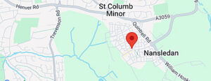
The Hub (Jo Lewis) This profile of the proposal for a new Methodist Centre has been compiled by Jo Lewis. The Hub is located at Nansledan, a newly built community development which is being led and managed by the Duchy of Cornwall, which owns the majority of the land there. In 2009, the three remaining…Continue Reading “Mapping Methodism – Newquay United Methodist Centre”
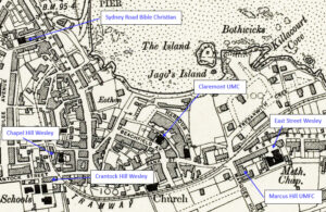
Map: https://maps.nls.uk/geo/explore/side-by-side/#zoom=10.4&lat=52.44811&lon=-3.07812&layers=6&right=ESRIWorld This profile Newquay Marcus Hill UMFC has been compiled by Jo Lewis and Tony Mansell. 1865: The congregation from Crantock Hill Chapel moved to this United Methodist Chapel on Marcus Hill (Steps Chapel). The chapel earned the nickname of “Spite & Envy”. 1892: Closed. Congregation moved to Claremont United Methodist Chapel in Beachfield Avenue. (Jo Lewis) …Continue Reading “Mapping Methodism – Newquay Marcus Hill United Methodist Free Church”
Map: https://maps.nls.uk/geo/explore/side-by-side/#zoom=10.4&lat=52.44811&lon=-3.07812&layers=6&right=ESRIWorld This profile of Sydney Road Bible Christian Chapel has been compiled by Jo Lewis Bible Christians were probably first Methodist society in Newquay. Circa 1802: Unsuccessful attempt to establish a Wesleyan Society meeting in a fisherman’s cottage near where the harbour would later be built. 1809/1810: William Bryant (later O’Bryan) established a Society in…Continue Reading “Mapping Methodism – Newquay Sydney Road Bible Christian Chapel”

