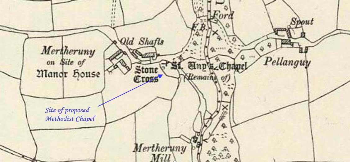
This profile of the proposed St Uny Methodist Chapel was compiled by Jo Lewis and Tony Mansell.
It was to be built near the ancient St Uny chapel at Metheruny House, southeast of Wendron.
From the Greek road, take a west turn to Metheruny. The location is no longer accessible by turning north so can only be reached by following this road on and then turning right up a road, marked public bridleway to the Merther Uny house where there was an ancient chapel of St Uny. The bridleway / footpath goes past the site. Arial maps show the old chapel area now covered by trees to the east of the site. By 1745 it was recorded as being in ruins, but the tower was still standing. The tower was removed in around 1820.
19th century: A failed attempt to build a Methodist chapel on the site.
1918: All traces of the building removed.
