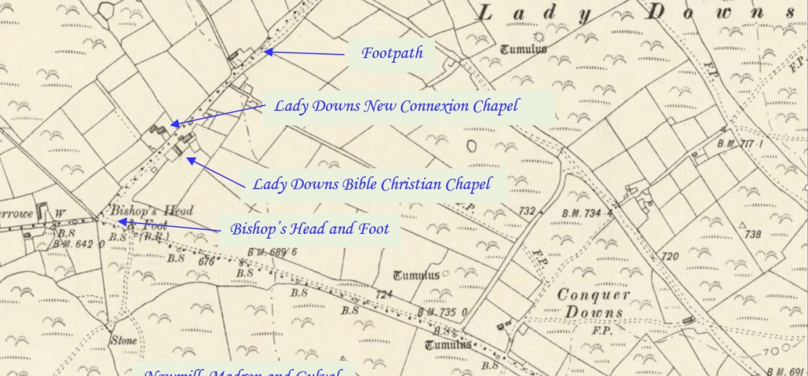
Carharrack is a village two miles east of Redruth in a former mining area. Its first Bible Christian Chapel was situated some way from the centre of the village and was later replaced by a more central place of worship. This profile has been compiled by Tony Mansell with information provided by Barrie May of…Continue Reading “Mapping Methodism – Carharrack Bible Christian Chapel”

Tregerthen is a farm on what is known as the Zennor ‘Churchway’. The ‘Churchway’ leads from Hellesveor, at the top of St Ives, to Zennor and on to Pendeen, and was supposed to be a coffin path from Church to Church, but this is debatable. ‘Tregerthen’ means ‘rowan-tree farm’, the rowan tree or mountain ash…Continue Reading “Mapping Methodism – Tregerthen (Tregarthen) Bethesda Bible Christian Chapel”

Boswarthen is a hamlet between Madron and Morvah. On early maps this hamlet is variously named Buswarthen, Buswarton and Buswarthen. It is a very historic settlement with one of the farms having the date 1676 on a stone.  The main industry of the area was farming and mining as it is close to Greenburrow (Ding…Continue Reading “Mapping Methodism – Boswarthen Wesleyan Chapel”

St Day is a village between Chacewater and Redruth. This profile of Wesleyan Methodist Association has been compiled by Jo Lewis and Tony Mansell with information provided by Barrie May of Carharrack.   Circa 1835: St Day Wesleyan Methodist Association here. Burnwithian had long acted as a sort of institutional suburb of St Day. In…Continue Reading “Mapping Methodism – St Day (Burnwithen) Wesleyan Methodist Association Chapel”