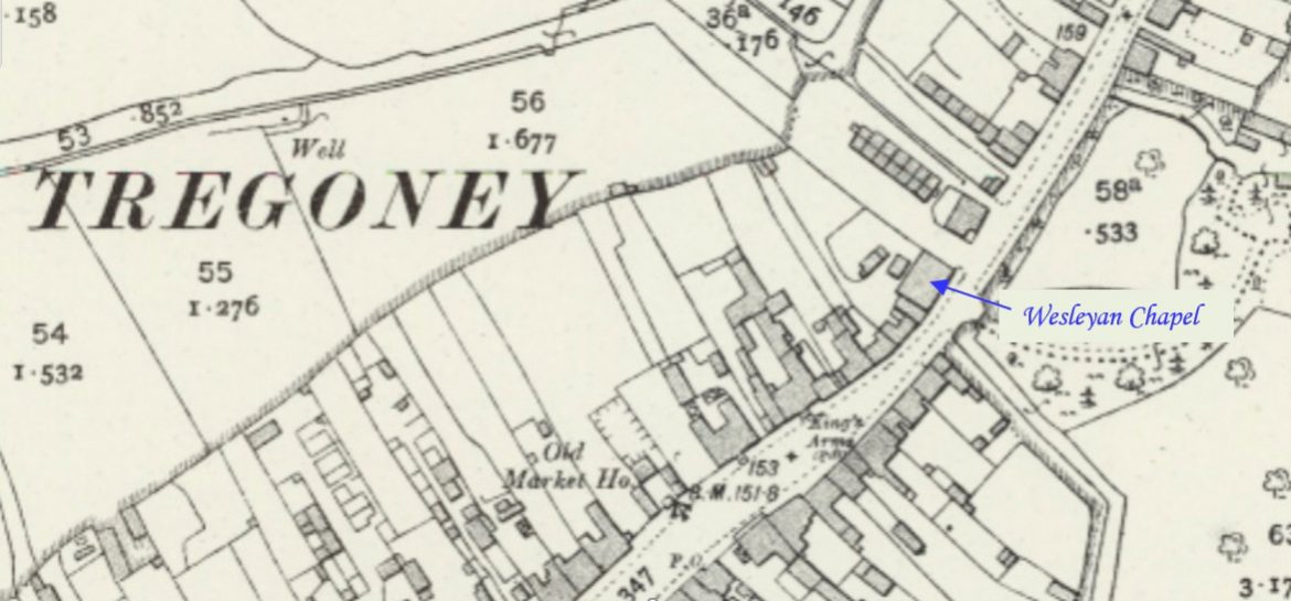
Angarrack is a village in west Cornwall, a mile to the east of Hayle. This profile of Angarrack Wesleyan Chapel has been compiled by Jo Lewis and Tony Mansell.   A Wesleyan Methodist chapel is recorded on the 1st and 2nd Editions of the 1:2500 OS maps and on the 1930’s revision.   7th August 1743: Charles…Continue Reading “Mapping Methodism – Angarrack Wesleyan Chapel”

Located on Hendra Lane at the site of Hendra Farm. This profile of Hendra Wesleyan Chapel has been compiled by Jo Lewis and Tony Mansell.   A Wesleyan Methodist chapel is recorded on the 1st Edition 1:2500 1880 OS Map. The same building is shown on the 1907 OS Map but not labelled. It is…Continue Reading “Mapping Methodism – Hendra Wesleyan Chapel, Breage”

Condurrow is a small hamlet on the southern outskirts of Camborne. It lies in the heart of mining country, just off the Great Flat Lode and overlooking Condurrow and Grenville mines. This profile of Lower Condurrow Wesleyan Chapel has been compiled by Suzanne Trythall.   c1841: Lower Condurrow Wesleyan Chapel opened 29 October 1850: received…Continue Reading “Mapping Methodism – Lower Condurrow Wesleyan Chapel”

Polmassick is a hamlet in the parish of St. Ewe about half a mile south-west of St. Ewe Churchtown. This profile of Polmassick Bible Christian Chapel was compiled by Mark Mitchley.   Denomination:                                    Bible Christian Location:                                             Polmassick Opened:                                              31st July 1836 Closed:                                                 c. 1985 Sunday School:                                    Yes, closed c. 1941 and earliest record…Continue Reading “Mapping Methodism – Polmassick Bible Christian Chapel”

Calvadnack is a 130 acres (53 hectares) area of heathland 3.7 miles (6.0 km) south-east of Camborne and south-west of the hill of Carnmenellis. This profile of Calvadnack Wesleyan Association Chapel has been compiled by Jo Lewis and Tony Mansell.   Hunt records a nineteenth century Wesleyan Association Chapel at this location (b1). It has been converted into…Continue Reading “Mapping Methodism – Calvadnack Wesleyan Association Chapel”

Tuckingmill is a village in the civil parish of Camborne. This profile of Tuckingmill United Methodist Free Church has been compiled by Jo Lewis and Tony Mansell.   A United Methodist chapel is recorded at this location in Tuckingmill on the 1st Edition 1:2500 c1880 OS Map. On the 2nd Edition 1:2500 OS map c1907 it…Continue Reading “Mapping Methodism – Tuckingmill United Methodist Free Church”