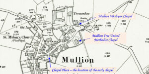
This profile of Mullion WMA/UMFC has been compiled by Jo Lewis. This history of the Mullion United Methodist Church is written with reference to the history of the Mullion Wesleyan Church. http://cornishstory.com/2021/03/05/mapping-methodism-mullion-wesleyan-chapel/ John Wesley visited Mullion on 7 September 1762 and there was an existing society, the Mullion society. Mullion Early Wesleyan Meeting place (Wesleyan Commerative…Continue Reading “Mapping Methodism – Mullion Wesleyan Methodist Association / UMFC”
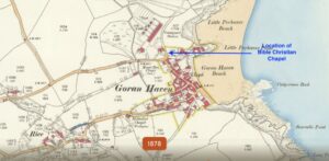
By Jo Lewis and Mark Mitchley Denomination: Bible Christian Location at Cliff Close, Gorran Haven Opened: ? August 1831 Closed: c. ?1846 Anniversary: Sunday School: No Sunday School building: No Sunday School anniversary: none Current status: Demolished Multiple references suggest an early Independent Chapel in Gorran Haven in the early 1800s. It is…Continue Reading “Mapping Methodism – Gorran Haven Bible Christian Chapel”
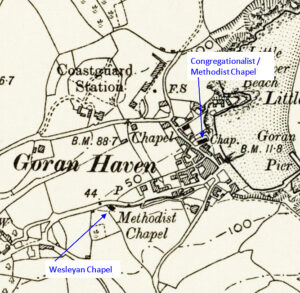
Profiled by Mark Mitchley and Jo Lewis Denomination: Wesleyan Methodist Located at Canton, Gorran Haven Opened: 1830 Closed: c. 2000 Anniversary: Sunday School: Yes Sunday School building: No Sunday School anniversary: July Current status: Converted to residential use from 2013 Book: ‘The History of Gorran Haven Methodists 1830-1980’, Robert C. Murrish (minister), printed privately,…Continue Reading “Mapping Methodism – Gorran Haven Wesleyan Chapel”
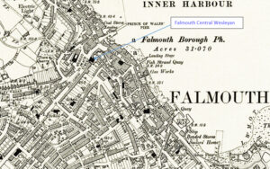
Map: https://maps.nls.uk/geo/explore/side-by-side/#zoom=10.4&lat=52.44811&lon=-3.07812&layers=6&right=ESRIWorld This profile of Falmouth Central Wesleyan Chapel has been compiled by Jo Lewis and Tony Mansell. Located in Market place, on the southern side of The Moor. In the mid-C18, the Falmouth Methodists were meeting in a room on Porhan Hill, and there was probably also a meeting place off Church Street. John…Continue Reading “Mapping Methodism – Falmouth Central Wesleyan Chapel”
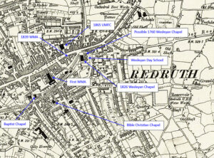
Map: https://maps.nls.uk/geo/explore/side-by-side/#zoom=10.4&lat=52.44811&lon=-3.07812&layers=6&right=ESRIWorld This profile of Redruth Wesleyan Chapel has been compiled by Jo Lewis. Wesleyan history: https://dmbi.online/index.php?do=app.entry&id=2272 Redruth Early Preaching House /Methodist History An early Methodist society may have existed in Redruth as early as 1743. Between 1743 and 1789 John Wesley paid 29 visits to Redruth, frequently preaching at the entrance to the…Continue Reading “Mapping Methodism – Redruth Wesleyan Chapel”
Map: https://maps.nls.uk/geo/explore/side-by-side/#zoom=10.4&lat=52.44811&lon=-3.07812&layers=6&right=ESRIWorld This profile of Redruth WMA has been compiled by Jo Lewis and Tony Mansell. First Wesleyan Methodist Association Chapel A larger map of the WMA / UMFC The Wesleyan Methodist Association came to Redruth early with meetings in the new Buttermarket, Station Hill. The Wesleyan Association was one of the…Continue Reading “Mapping Methodism – Redruth Wesleyan Methodist Association”

