
Mapping Methodism – Lower Prospidnick Wesleyan Chapel
Categories Mapping Methodism, Projects0 Comments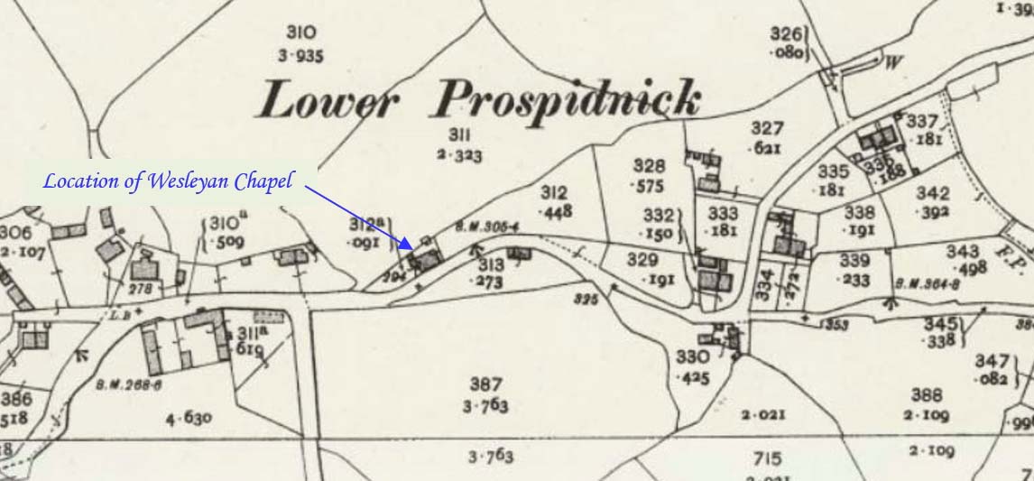
Prospidnick is a small village and hill in the parish of Sithney 0.6 miles east of Crowntown and 2.6 miles west of Wendron by road. It is divided into Lower Prospidnick and Higher Prospidnick. This profile of Lower Prospidnick Wesleyan Chapel has been compiled by Jo Lewis and Tony Mansell.
Continuing east from Chynhale, the chapel was on the left adjacent to the road which forks left at the right turn to Tregathenan just before a bend in the road before the village and after the railway.
A Wesleyan Methodist chapel is recorded at Lower Prospidnick on the 1st Edition 1:2500 1880 OS Map. Converted to a dwelling by 1980. (b1). Late C19. Rubble with granite dressings. Front end has stepped 3-light lancet window with hoodmoulds; coped gable with finial. Good forecourt walls with ramped dressed granite coping. Overall a well detailed small Gothic style chapel. Cornwall Heritage Gateway)
Build date unknown.
1877: Indicated on maps.
1907: No longer shown on maps.
1884: Symons notes a Wesleyan chapel.
1980s: Become residential – The (Old) Chapel.