
Mawla is a village south of Porthtowan. This profile of Mawla Wesleyan Chapel has been compiled by Clive Benney & Tony Mansell.
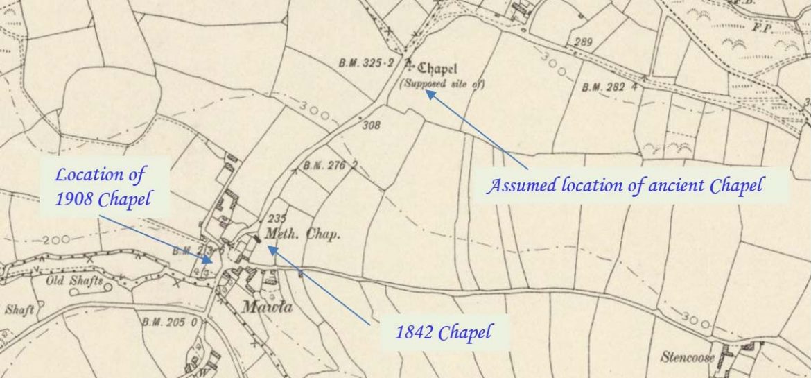
Ancient chapel
1805: Lysons referred to the remains of an ancient chapel at Mola.
The site of a chapel mentioned by Tonkin (b) and various C19 histories (b2, b10) and marked on 1st edition OS map (b12), but no remains are visible (b11). It was about a quarter mile north-east of Mawla on the eastern side of the road (b5). There is some dispute over whether the font at Mount Hawke is from here (b8) or from Trevaunance (b9). Henderson also wonders whether there would have been a font here at all since even St Agnes did not have full baptismal rights (b7). In 1847 the measurements of the chapel are recorded as 8.0m long and 5.0m high (b8). (Cornwall Heritage Gateway)
1842 Chapel
A Wesleyan Methodist chapel in Mawla is recorded on the 1st and 2nd Edition 1:2500 1880 and 1907 OS Maps. It is still extant and shown on the current Mastermap as a Sunday School, a new chapel having been constructed across the road to the west sometime after 1907. (Cornwall Heritage Gateway)
1842: Mawla Wesleyan chapel built.
Seating for a congregation of 120.
The chapel was also used for the Sunday school.
The chapel was “by the side of the high road to Menagissey, about half a mile beyond Mawla Farm”. (Maurice Bizley)
1847: Mr Newton recorded in a paper to the Royal Institution of Cornwall that Mawla Chapel was 25 to 30 feet long by 16 feet wide and had recently been used as a cows’ house. He said that the font together with all the other remarkable parts of the building were gone. (Presumably, this is the chapel referred to by Lysons)
1908 Chapel
1883: “MAWLA. At the Cornwall Wesleyan District Meeting, the meeting heard with great pleasure, and reported to the Conference for grateful acknowledgment, the almost unique action the part of Mr E. W. Brydges Williams. M.P. for Truro, who has given the freehold of the chapel at Mawla. in the Redruth Circuit.” (Cornubian and Redruth Times – Friday 01 June 1883)
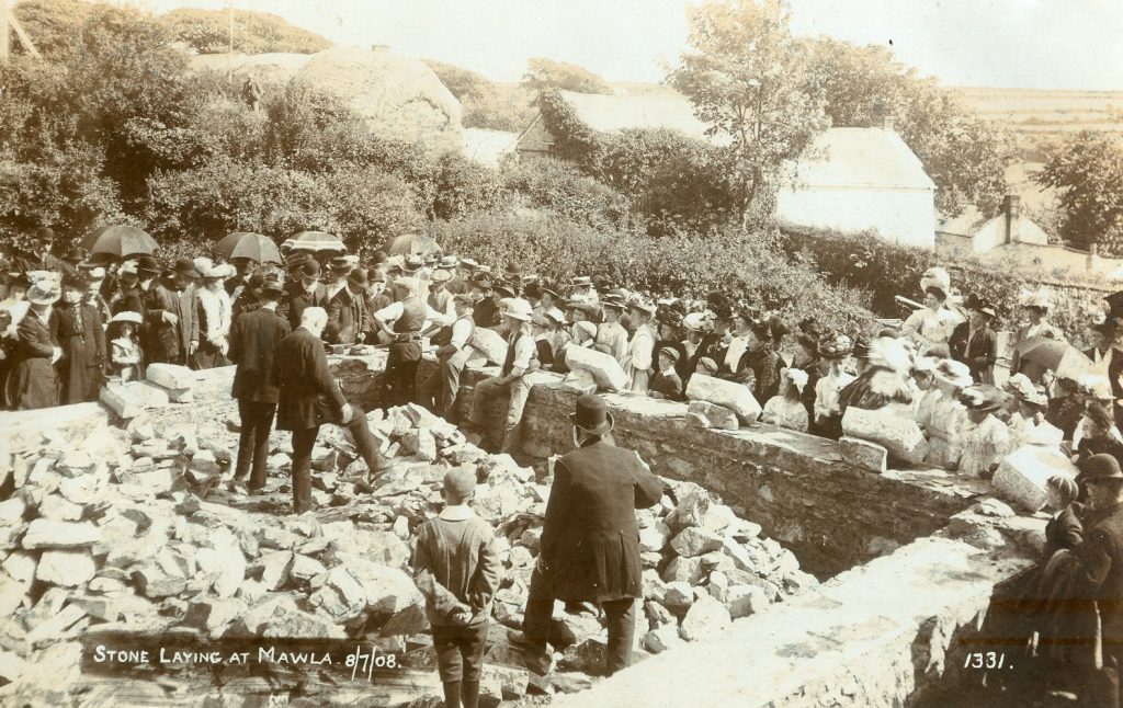
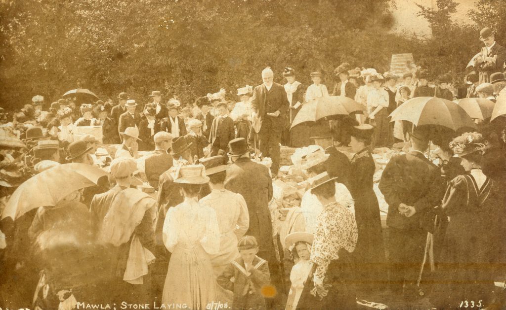
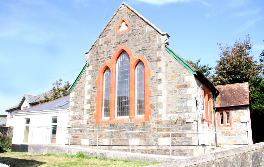
1908 – 8th July: Foundation stone laid for new chapel.
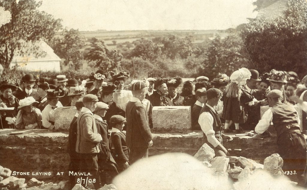 1908: Laying the foundation stone (Photo: courtesy Clive Benney)
 1908: Laying the foundation stone (Photo: courtesy Clive Benney)
 1908: Laying the foundation stone (Photo: courtesy Clive Benney)
1909: Opening of new chapel. (SWChurches)
Built as a Wesleyan chapel. (SWChurches)
Part of Redruth Wesleyan Circuit. (SWChurches)
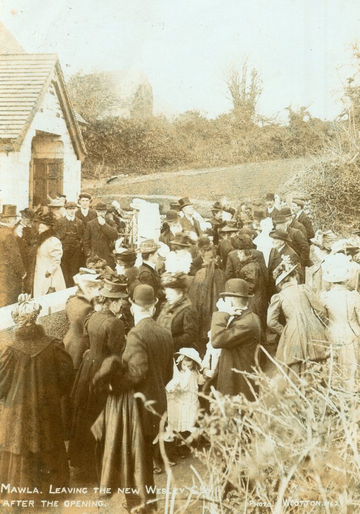 1908: Leaving the chapel after the opening (Photo: courtesy Clive Benney)
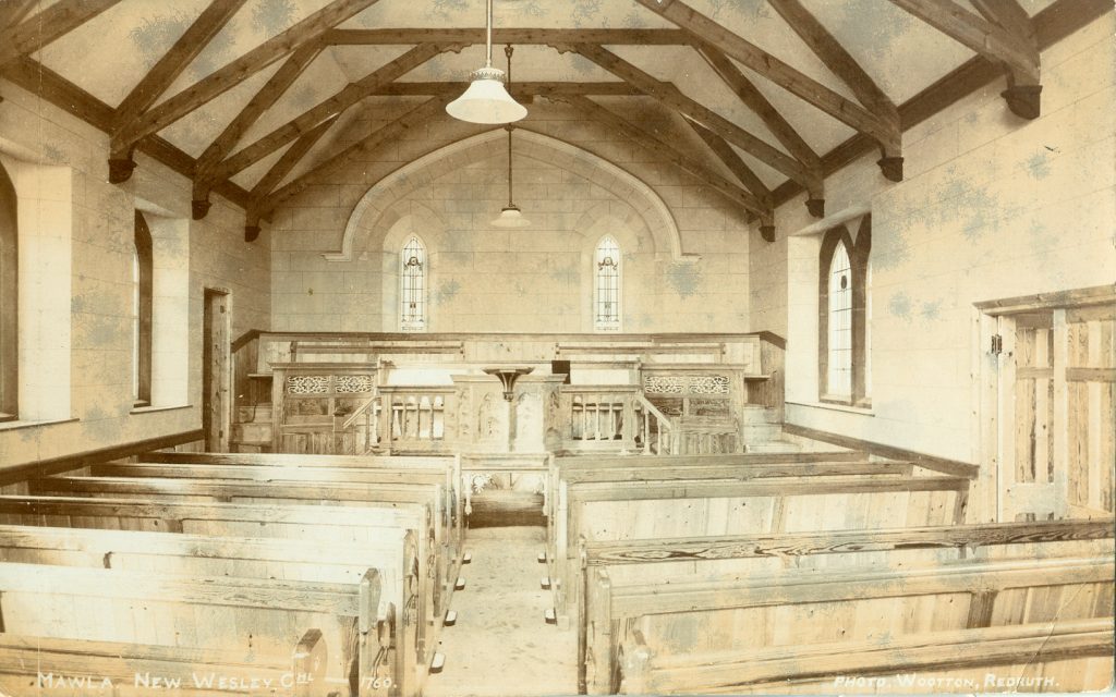 The interior of the 1908 chapel (Photo: courtesy Clive Benney)
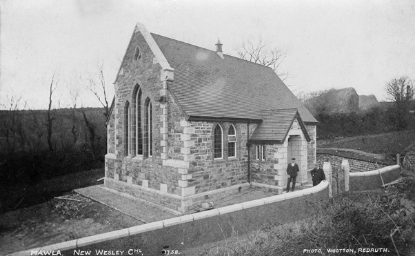 (Photo: courtesy Clive Benney)
The 1842 chapel continued to be used for the Sunday school when services transferred to the 1908 chapel about 50 yards away.
The 1842 chapel was considered unsafe and demolished.
Peter Simmons of Mawla, whose family farmed the field in question, recalled pieces of foundation being removed from the field, appropriately named Chapel Croft. (We are unsure if this refers to the chapel mentioned by Lysons or the 1842 chapel)
1932: The Wesleyan, Primitive Methodist and the United Methodist Church amalgamated to become the Methodist Church of Great Britain.
1932: Became Mawla Methodist Church. (SWChurches)
Part of Redruth Methodist Circuit. (SWChurches)
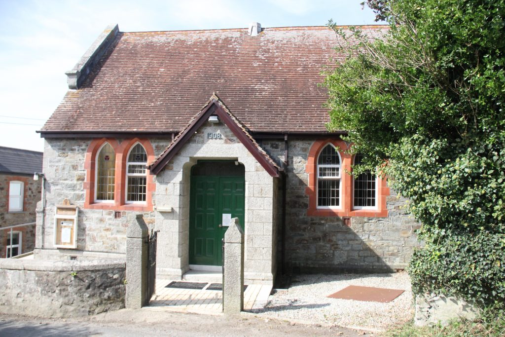 2020 (Photo: Tony Mansell)
2008: New community hall built next to chapel.
 2020 showing hall/schoolroom (Photo: Tony Mansell)
Brilliantly put together. Well done.
Very interesting as usual!