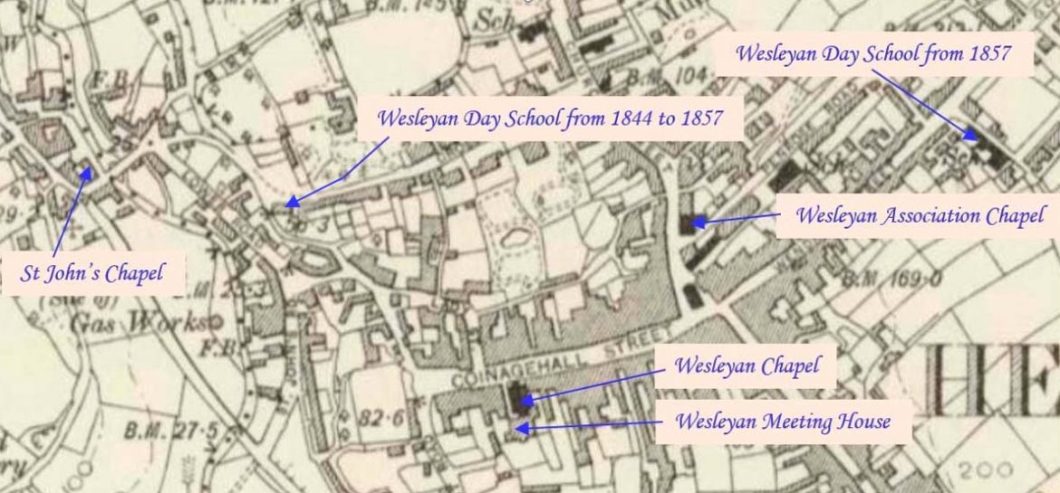
Helston is a town at the northern end of the Lizard Peninsula approximately 12 miles (19 km) east of Penzance and 9 miles (14 km) south-west of Falmouth. This profile of Helston Wesleyan Association Chapel has been compiled by Betty Pascoe.   Church Street Chapel Interior Church Street Chapel drawn by Reg Jenkin Remains of Church Street Chapel – basement level…Continue Reading “Mapping Methodism – Helston Wesleyan Association Chapel”

Barripper is a village approximately one mile south-west of Camborne. This profile of Barripper United Methodist Free Church has been compiled by Jo Lewis and Tony Mansell.   The first United Methodist chapel in Barripper is recorded at this location on the 1st Edition 1:2500 1880 OS Map. By 1907 the new Free United Methodist…Continue Reading “Mapping Methodism – Barripper United Methodist Free Church”

Penponds is a village to the west of Camborne. This profile of Penponds Bible Christian Chapel has been compiled by Jo Lewis and Tony Mansell.   Heading south through Penponds, the old chapel is on the right just before the railway bridge. Bible Christians Chapel, now Methodist church. Dated 1844 in gable. Gabled facade of…Continue Reading “Mapping Methodism – Penponds Bible Christian Chapel”

Roscroggan is a hamlet to the north of Camborne. This profile of Roscroggan United Methodist Free Church has been compiled by Jo Lewis and Tony Mansell.   Following the road on from Rescroggan Wesleyan Church, the United Methodist chapel was on the left just on the turn in the road by a small left track…Continue Reading “Mapping Methodism – Roscroggan United Methodist Free Church”