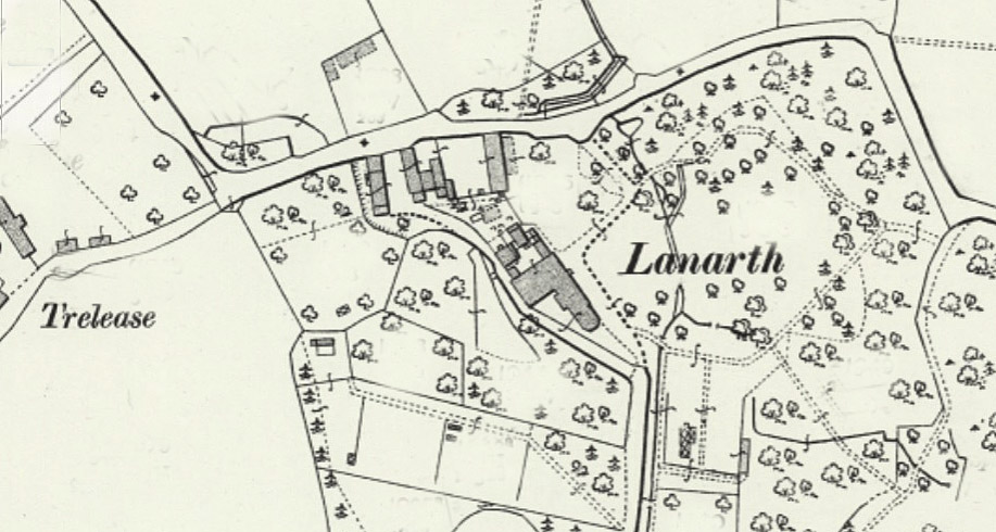
The chapel is located to the west of Rosemear, on the road to Helston. This profile of Bowgyhere UMFC has been compiled by Jo Lewis and Tony Mansell.   From the B3293 heading west from Rosevear, take the right turn signposted to Constantine and Gweek. There is a right turn (to Park-an-fold) opposite a sign…Continue Reading “Mapping Methodism – Bowgyhere United Methodist Free Chapel”

Berepper is a coastal village in south Cornwall on the west side of the Lizard peninsula, four miles south of Helston, near Gunwalloe. This profile of Berepper UMFC has been compiled by Jo Lewis and Tony Mansell.   Methodist Chapel (Wesleyan) is recorded at this location on both the 1st and 2nd Edition 1:2500 OS…Continue Reading “Mapping Methodism – Berepper (Beripper) Gunwalloe Wesleyan Chapel”

Berepper is a coastal village in south Cornwall on the west side of the Lizard peninsula, four miles south of Helston, near Gunwalloe. This profile of Berepper UMFC has been compiled by Jo Lewis and Tony Mansell.   By the north side of the road in the west of the village. The site of a…Continue Reading “Mapping Methodism – Berepper (Beripper) Gunwalloe United Methodist Chapel”

Polgigga is a hamlet in west Cornwall on the B3315 Land’s End to Penzance road and within the civil parish of St Levan. It is eight miles west of Penzance and two miles east of Land’s End. This profile of St Levan Little Trethewey Wesleyan Chapel has been compiled by Jo Lewis and Tony Mansell….Continue Reading “Mapping Methodism – St Levan Little Trethewey Wesleyan Chapel, Polgigga”

St Buryan lies five miles west of Penzance; and was anciently a town of great importance. This profile of St Buryan Wesleyan Chapel has been compiled by Jo Lewis and Tony Mansell.   John Wesley, the founding father of Methodism, visited the parish on several occasions, but was not well received at first. He first…Continue Reading “Mapping Methodism – St Buryan Wesleyan Methodist Chapel”