
 Map:
Map:
This profile of Gwinear Wesleyan Chapel was compiled by Jo Lewis.
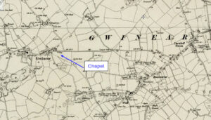
Approaching Gwinear from the East, the Wesleyan chapel was south of the road, set down a short track in a field. There is still a gap in the wall at this point, just before the houses start on the right but no chapel remains.
Heritage Gatway: A Wesleyan Methodist chapel to the south of the main road in Gwinear is recorded on the 1st and 2nd Edition 1:2500 1880 and 1907 OS Maps. On the current Mastermap there is no longer a building on the site.
https://www.heritagegateway.org.uk/Gateway/Results_Single.aspx?uid=MCO52188&resourceID=1020