
Marazion is a town, on the shore of Mount’s Bay. It is 2 miles (3.2 km) east of Penzance and the tidal island of St Michael’s Mount is half-a-mile offshore. This profile of Marazion Methodist Free Church has been compiled by Jo Lewis and Tony Mansell.
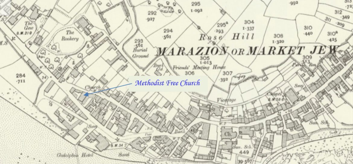
Free Methodist chapel, [Methodist Free Church] now used as commercial premises. Granite rubble with granite dressings under a slate roof with crested clay ridge tiles, front gable end as pediment. Simple classical style. Symmetrical 2-window front. Original sash windows throughout with fanlight heads; spoked fanlight also to central doorway with pair of panelled doors. Interior not inspected. (Cornwall Heritage Gateway)
Non-Conformist. There were chapels for the Wesleyan Methodists, United Methodist Free Church, Bible Christians and Baptists. (Genuki)
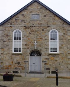 Marazion Methodist Free Church 1862 (Photo: Terry Knight)
1862: Build date. (Cornwall Heritage Gateway / Plaque)
Built as a Methodist Free Church. (Cornwall Heritage Gateway / Plaque)
Originally a United Free Church. (David Easton, Methodist Minister and historian)
SWChurches state that it was built as a Bible Christian chapel but this is unlikely, although not impossible, as there was a Bible Christian Chapel elsewhere in Marazion and the plaque states that it was a Methodist Free Church. Newspaper reports of Marazion Bible Christian Chapel cease in 1901, indicating that it was extremely unlikely that the movement extended its life beyond that date by moving to this or any other chapel.
Known as Ebenezer Church.
1875: Shown on map as Wesleyan. (old.map.co.uk) Was it taken over by the Wesleyans chapel or is this a mapping error?
1877: Start date. (SWChurches) Possibly registration date.
1907: The Methodist New Connexion, Bible Christians and United Methodist Free Churches amalgamated to become the United Methodist Church.
1907: Became a United Methodist Church. (SWChurches / David Easton, Methodist Minister and historian)
1932: The Wesleyan, Primitive Methodist and the United Methodist Church amalgamated to become the Methodist Church of Great Britain.
1932: Became Ebenezer Methodist Church. (SWChurches)
1940: Seating for 250. (David Easton, Methodist Minister and historian)
1960s-70s: Closed. (SWChurches)
1965: Closed. (David Easton, Methodist Minister and historian)
Subsequently used as a boat builder’s yard, offices and garages, and Builder’s Yard and Workshops.
It is grade 2 listed.
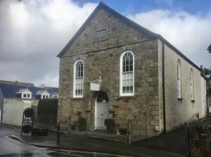 Marazion Methodist Free Church 1862 (Photo: Jo Lewis)
Now divided into 2 residential homes