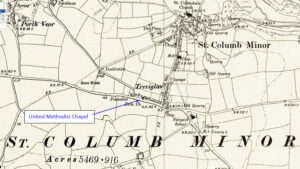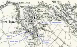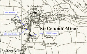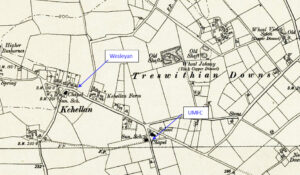
Map: https://maps.nls.uk/geo/explore/side-by-side/#zoom=10.4&lat=52.44811&lon=-3.07812&layers=6&right=ESRIWorld This profile of Kehelland Wesleyan Chapel has been compiled by Jo Lewis and Tony Mansell. Methodist Meetings / The Meeting House There was an early Methodist Society in Kehelland. Kehelland features on a Redruth Circuit week night Preachers’ Plan of about 1818. 1828: The Camborne Circuit book records that there were 62…Continue Reading “Mapping Methodism – Kehelland Wesleyan Meeting House and Chapels”