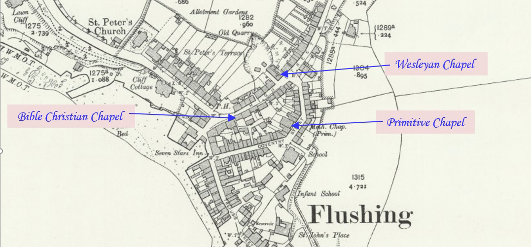
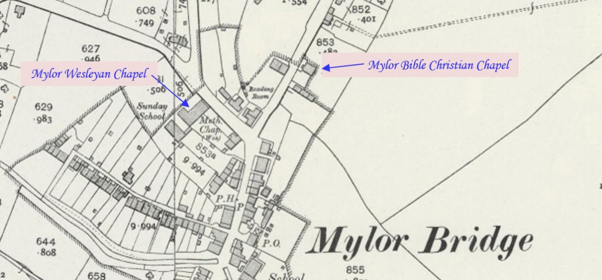
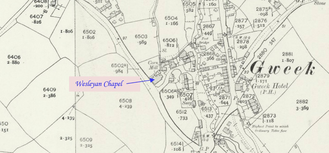
Rose is a hamlet to the north-west of Goonhavern and east of Perranporth. This profile of Rose Wesleyan Chapel has been compiled by Karin Easton, President of the Federation of Old Cornwall Societies and member of Perranzabuloe OCS.   Rose Chapel Circa 1900 (Photo courtesy Goonhavern Old Cornwall Society) Information taken from Rose: the story…Continue Reading “Mapping Methodism – Rose Wesleyan Chapel”

Nancegollan is a village on the B3303 road and south-east of Leedstown. The railway line from Helston to Hayle passed through the village (closed in 1964). Nancegollan station was the largest of the four stations on the branch. This profile of Nancegollan Wesleyan Chapel has been compiled by Jo Lewis and Tony Mansell,   1813…Continue Reading “Mapping Methodism – Nancegollan Wesleyan Chapel”

Porth Kea is a hamlet southeast of Kea in Cornwall. This profile of Porthkea Wesleyan Chapel has been compiled by Jo Lewis and by Tony Mansell.   Porthkea Wesleyan Chapel (Photo: Jo Lewis) From Calenick, drop south to Porth Kea. Turning north towards Trevaster, The Wesleyan Chapel sits in a fork in the road. Wayside…Continue Reading “Mapping Methodism – Porthkea Wesleyan Chapel”

Sunny Corner is in the Gwennap mining area. This profile of Sunny Corner Wesleyan Chapel has been compiled by Jo Lewis and Tony Mansell.   Sunny Corner Chapel (Photo: courtesy David Thomas) Built as a Wesleyan chapel. (SWChurches) The chapel was part of Gwennap Wesleyan Circuit. (SWChurches) 1892: The tenancy of the chapel was surrendered. (SWChurches)…Continue Reading “Mapping Methodism – Sunny Corner Wesleyan Chapel”

Trescowe is a hamlet north of Germoe. This profile of Trescowe Wesleyan Chapel has been compiled by Jo Lewis and Tony Mansell.   A Wesleyan Methodist chapel is recorded on the 1st and 2nd Editions 1:2500 1880 and 1907 OS Maps. The building survives and is shown on the current Mastermap as the ‘The Old…Continue Reading “Mapping Methodism – Trescowe Wesleyan Chapel”

Trescowe is a hamlet north of Germoe. This profile of Trescowe UMFC has been compiled by Jo Lewis and Tony Mansell.   A United Methodist chapel is recorded on the 1st 1:2500 1880 OS Map and shown as a Free United chapel on the 2nd Edition 1907 OS Map. The building is shown on the…Continue Reading “Mapping Methodism – Trescowe United Methodist Free Church”