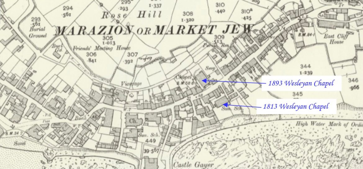
Lanner is a village situated on the A393 about 2 miles (3.2 km) south-east of Redruth. This profile of Lanner Primitive Methodist Chapel has been compiled by Jo Lewis and Tony Mansell.   The chapel is in Lanner Moor, just beyond Lanner on the Redruth to Falmouth Road, on the right next to the petrol station….Continue Reading “Mapping Methodism – Lanner Moor Primitive Methodist Chapel”

Lanner is a village situated on the A393 about 2 miles (3.2 km) south-east of Redruth. This profile of Lanner Wesleyan Chapel has been compiled by Jo Lewis and Tony Mansell.   Lanner Wesley had been on the circuit plan long before the building took place in 1828, so a meeting place or Chapel of some…Continue Reading “Mapping Methodism – Lanner Wesleyan Chapel”

Ponsanooth is a hamlet 3 miles N.W. of Penryn, and 6 from Truro. It is situated on the road from Falmouth and Redruth to Penryn. This profile of Ponsanooth Wesleyan Chapel was compiled by Jo Lewis and Tony Mansell.   1813: Cemetery opened behind the site ofthe chapel. Said to be two previous chapels on…Continue Reading “Mapping Methodism – Ponsanooth Wesleyan Chapel”

Longdowns is a village situated on the A394 road approximately three miles (4.8 km) west of Penryn and in the civil parish of Stithians. This profile of Longdowns Wesleyan Chapel has been compiled by Jo Lewis and Tony Mansell.   A small wayside Methodist chapel (Wesleyan) is recorded at this location on both the 1st…Continue Reading “Mapping Methodism – Longdowns Wesleyan Chapel”

Townshend is a small village near Leedstown and Godolphin.   1852 Chapel Wesleyan chapel at Bunkers Hill, plus stable and trap house, used as Sunday school after 1871 chapel built across the road (138235), now used as a village hall. Early C19. Lime-washed rubblestone; scantle slate roofs (with gable ends). 3 x Picturesque Gothic sash…Continue Reading “Mapping Methodism – Townshend Wesleyan Chapel”

Horse Downs Chapel is near Leedstown and not far from the St Aubyn, Clowance Estate.   A Wesleyan Methodist chapel is recorded on the 1st and 2nd Edition 1:2500 1880 and 1907 OS Maps to the south of the settlement of Horsedowns. (Cornwall Council Heritage Gateway) 1806: Built as a Wesleyan chapel. (Checklist of Chapels in…Continue Reading “Mapping Methodism – Horse Down(s) Wesleyan Chapel”