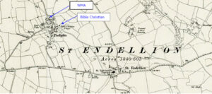
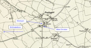
Map: https://maps.nls.uk/geo/explore/side-by-side/#zoom=15.6&lat=50.57430&lon=-4.83038&layers=6&right=ESRIWorld This profile of Pendoggett United Methodist Free Church has been compiled by Jo Lewis and Tony Mansell Turning down the road opposite (road to St Kew) the chapel is on the left and is marked on maps as a Methodist Church (United Free) Heritage Gateway: United Free Methodist chapel (built to replace…Continue Reading “Mapping Methodism – Pendoggett United Methodist Free Church”
Map: https://maps.nls.uk/geo/explore/side-by-side/#zoom=10.4&lat=52.44811&lon=-3.07812&layers=6&right=ESRIWorld This profile of Brea Bible Christian Chapel has been compiled by Jo Lewis and Tony Mansell. Kresen Kernow documents: https://kresenkernow.org/SOAP/search/RelatedNameCode.keyword/CRO%7CUK%7C1291/ First Chapel Located at Chapel Hill north of a small road (now a footpath) that ran on the north boundary of the later chapel building, almost adjacent to the back of…Continue Reading “Mapping Methodism – Brea Bible Christian Chapel”
This profile of Portreath United Methodist Free Church has been compiled by Jo Lewis and Tony Mansell. Located at Primrose Terrace – turning up School Lane at the entrance to the village takes you to Primrose Terrace. The chapel was slightly to the left on the south side the road. Heritage Gateway: A United…Continue Reading “Mapping Methodism – Portreath United Methodist Free Church”
Map: https://maps.nls.uk/geo/explore/side-by-side/#zoom=10.4&lat=52.44811&lon=-3.07812&layers=6&right=ESRIWorld This profile of Mountjoy Wesleyan Chapel has been compiled by Jo Lewis and Tony Mansell. Located east of Quintrell Downs and south east of Colan – on the north side of the A392. Kresen Kernow documents: https://kresenkernow.org/SOAP/search/RelatedNameCode.keyword/CRO%7CUK%7C990/ First Mountjoy Wesleyan Chapel Located north of the A392, signposted Colan, and there is…Continue Reading “Mapping Methodism – Mountjoy / Mount Joy Wesleyan Chapel”
Map: https://maps.nls.uk/geo/explore/side-by-side/#zoom=15.3&lat=50.40478&lon=-5.06395&layers=6&right=ESRIWorld This profile of Lane Wesleyan Chapel has been compiled by Jo Lewis and Tony Mansell. Lane Wesleyan Chapel (Photo Jo Lewis) Located at the north-eastern corner of the A392 roundabout, where it meets the Treloggan Road connection to Newquay. This small chapel is a familiar landmark. Build date: 1879. 1879: New…Continue Reading “Mapping Methodism – Lane Wesleyan Chapel”
Map: https://maps.nls.uk/geo/explore/side-by-side/#zoom=17.4&lat=50.57839&lon=-4.84069&layers=6&right=ESRIWorld This profile of Trelights Wesleyan Chapel has been compiled by Jo Lewis and Tony Mansell. First Trelights Wesleyan Methodist Association Chapel Approaching the village from the north, the chapel is on the left before the centre of the village. Local history puts this chapel under Bible Christian History and continues to…Continue Reading “Mapping Methodism – Trelights Wesleyan Methodist Association Chapel”


