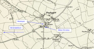
Map: https://maps.nls.uk/geo/explore/side-by-side/#zoom=15.6&lat=50.57430&lon=-4.83038&layers=6&right=ESRIWorld This profile of Pendoggett Wesleyan Chapel has been compiled by Jo Lewis and Tony Mansell Entering Pendoggett from the west on the B3314, the first Pendoggett chapel can be found to the left of the road opposite the right turn to St Kew, tucked behind the cottages on the main road. May…Continue Reading “Mapping Methodism – Pendoggett Wesleyan Chapel”