
Mapping Methodism – Calvadnack Wesleyan Association Chapel
Categories Mapping Methodism, Projects0 Comments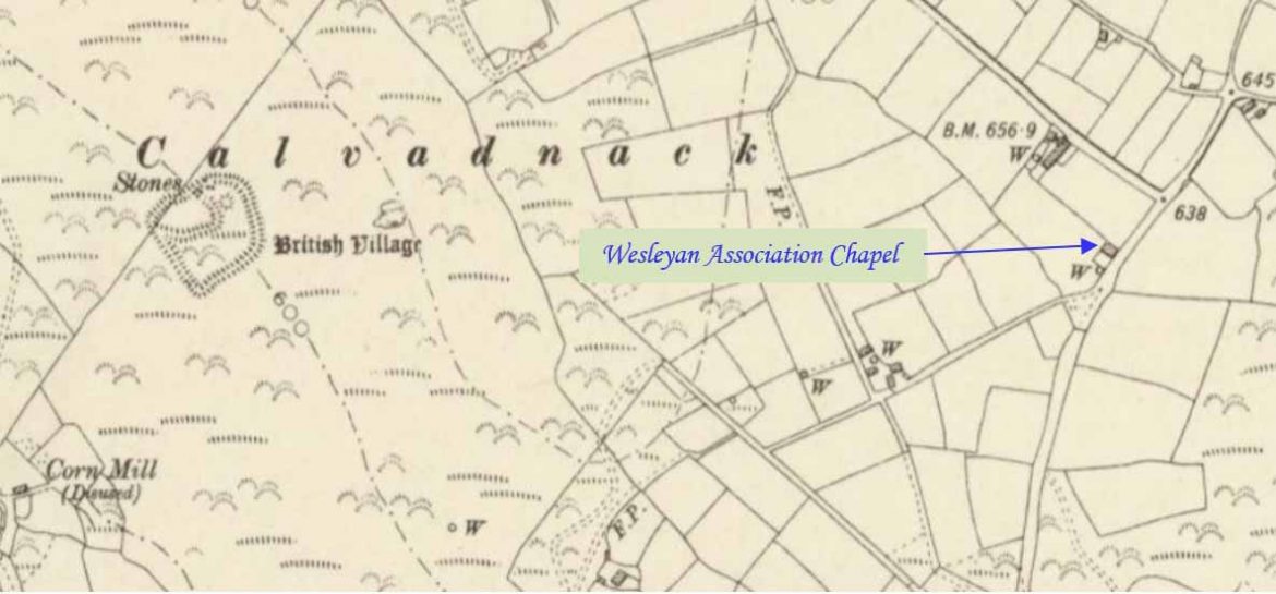
Calvadnack is a 130 acres (53 hectares) area of heathland 3.7 miles (6.0 km) south-east of Camborne and south-west of the hill of Carnmenellis. This profile of Calvadnack Wesleyan Association Chapel has been compiled by Jo Lewis and Tony Mansell.
Hunt records a nineteenth century Wesleyan Association Chapel at this location (b1). It has been converted into two dwellings. Each dwelling has a round buttress chimney; the two chimneys stand at either end of the building. (Cornwall Heritage Gateway)
Located on Cornwall Heritage Gateway map.
19th Century: Build date. (Cornwall Heritage Gateway)
Indicated on old maps but not as a chapel.
Unknown closure date.
Converted to residential.
It is called Association Cottage.
Planning listed it as a previously derelict cottage
It has some unusual windows (slightly chapel like) but also big chimneys which is unusual for old chapels