
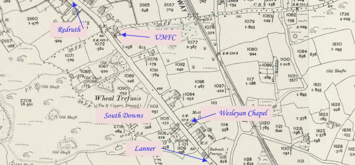
South Downs is an area of Reduth located on the road to Lanner. This profile of Redruth South Downs United Methodist Free Church has been compiled by Jo Lewis and Tony Mansell.
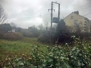 There is a footpath with a wall slightly to the left of this which marked the edge of the Church grounds. On the side-by-side maps, the end of the row of houses is where the chapel was, extending into the land seen in this photograph. (Photo: Jo Lewis)
A United Methodist (later Free United) chapel is recorded at this location on the 1st and 2nd Edition 1:2500 1880 and 1907 OS Maps. The Mastermap shows that the chapel has been converted to a dwelling. (Cornwall Council Heritage Gateway)
Build date unknown.
1880 to 1838: Appears on maps. (old-map.co.uk)
1892: United Methodist Free Church – South Downs – anniversary. (Cornubian and Redruth Times – Friday 07 October 1892)
Closure date unknown.
1962: Does not appear on map. (old-map.co.uk)
It is possible that the building on the right of the photo could be the old chapel, or perhaps built on its site. It is now a garage annexed to 1 Chapel Terrace and the brick work is different from the house. If this is the case then the chapel preceded the terrace of houses (known as Chapel Terrace) which were built abutting it before 1938, when the chapel is still marked on maps.