
Mapping Methodism – Bolenna Primitive Methodist Chapel, Perranporth.
Categories Mapping Methodism, Projects0 Comments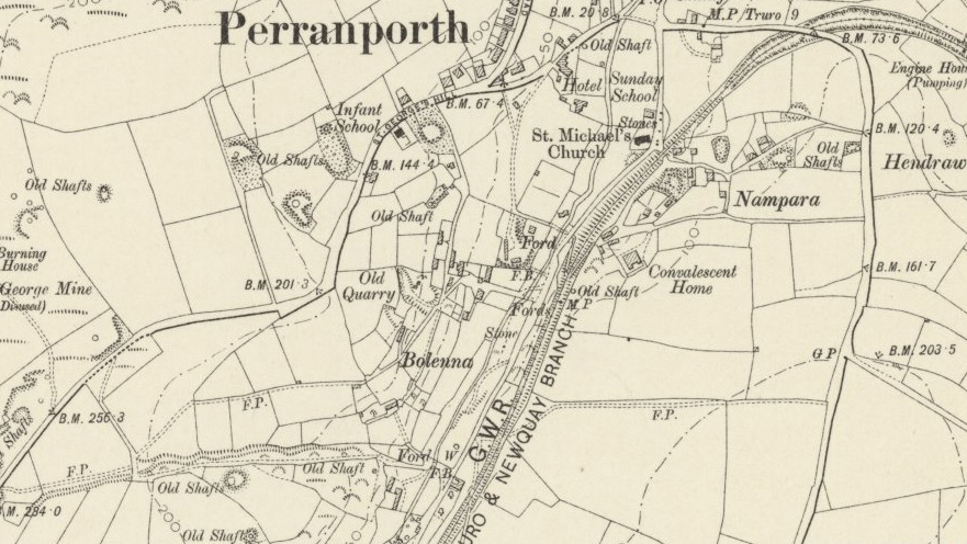
Perranporth is a seaside resort town on the north coast of Cornwall. It is a mile east of the St Agnes Heritage Coastline and around 8 miles south-west of Newquay. Perranporth and its 3 miles long beach face the Atlantic Ocean. The chapel location is unknown but could have been in Bolenna Lane. The material for this profile of Bolenna Primitive Methodist Chapel, Perranporth, has been provided by Mike Fairhead of Perranzabuloe Old Cornwall Society.
1836/37: There was preaching at Perrancoombe.
1845: The Primitive Methodist Society (probably Perranporth) had just two members.
1847: The Perranporth Primitive Methodist Society was asked to consider the possibility of building a chapel.
1847: The Bolenna Primitive Methodist Chapel was built for 100 worshippers. The location is unknown but the general area of Bolenna can be seen on the map.
1851: The Perranporth Primitive Methodist Society had ten members.
1851: The census records the building of Bolenna chapel in 1847.
1854: The Perranporth Primitive Methodist Society had no members and appears to have ceased to exist.
1861: Bolenna Chapel appeared on the preaching plan for a single quarter.
1867: The Perranporth Primitive Methodist Society seems to have become re-established and the people were asked if they required a chapel, what sort and what they would give towards it.
1884: We hear of the “Perranporth Chapel Case”.
1886: “Plans to purchase ground to build here”.
“We can probably assume that the 1847 chapel was lost with the demise of the first society, and that the plans for a second chapel never matured.”