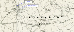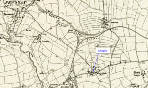
Map: https://maps.nls.uk/geo/explore/side-by-side/#zoom=15.3&lat=50.40478&lon=-5.06395&layers=6&right=ESRIWorld This profile of Lane Wesleyan Chapel has been compiled by Jo Lewis and Tony Mansell. Lane Wesleyan Chapel (Photo Jo Lewis) Located at the north-eastern corner of the A392 roundabout, where it meets the Treloggan Road connection to Newquay. This small chapel is a familiar landmark. Build date: 1879. 1879: New…Continue Reading “Mapping Methodism – Lane Wesleyan Chapel”