
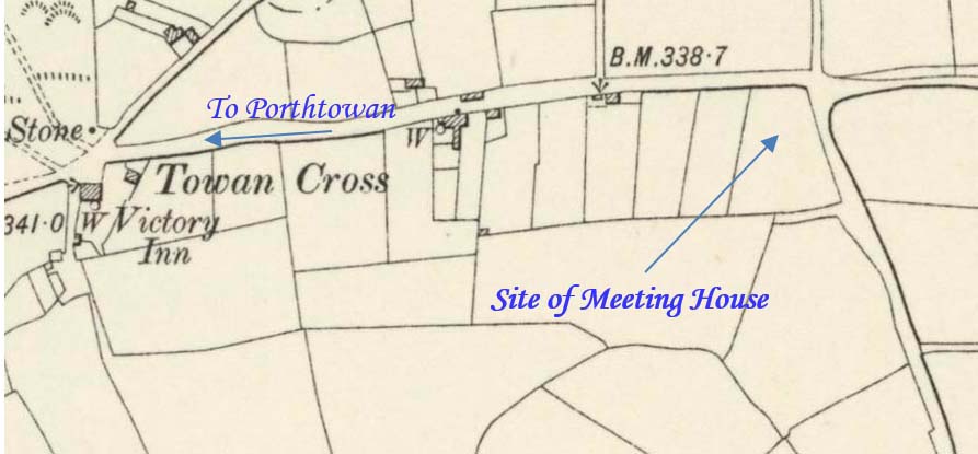
Towan Cross is a hamlet within the Mount Hawke, Porthowan and St Agnes triangle. The existence of this ancient chapel seems to have been ignored for many years but its inclusion on this 1835 map, and local tradition of a location known as “Bryanite Corner”, surely provides strong evidence of its existence. This profile has been compiled by Clive Benney and Tony Mansell.
 1835 Map
One reference describes this as a Primitive Chapel but that seems unlikely for two reasons. J C C Probert, an authority on Methodist Chapels, had not heard of it and the corner where it was located was referred to as “Bryans” or “Bryanite Corner,” surely a reference to William O’Bryan of Bible Christian fame.
1830 circa: Likely date of a chapel or meeting house in the field on the west corner of the junction of Banns and the coast road.
1835: The chapel is indicated on the Tin Bound map of that year.
“There was also a Bible Christian Chapel, probably about 1830 to 1840, near Towan Cross; the site is known as Brianite’s Corner”. (Ashley Rowe, historian)
Tradition has it that its location became known as Chapel Field and, although there is no longer any trace of the building, the location is still referred to as “Bryanite Corner”.
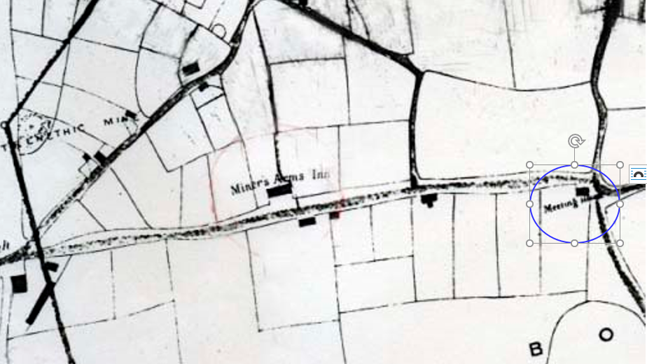
The crossroads at Towan Cross going down to Banns is near the site of the old Bryanite or Bible Christian Chapel, on Two Traps Corner. This was part of the old Banns Estate. (“Porthtowan and Towan Cross” by Caroline Palmer)