
Carnhell Green is a hamlet approximately three miles (5 km) southwest of Camborne. This profile of Carnhell Green Wesleyan Chapel has been compiled by Jo Lewis and Tony Mansell.
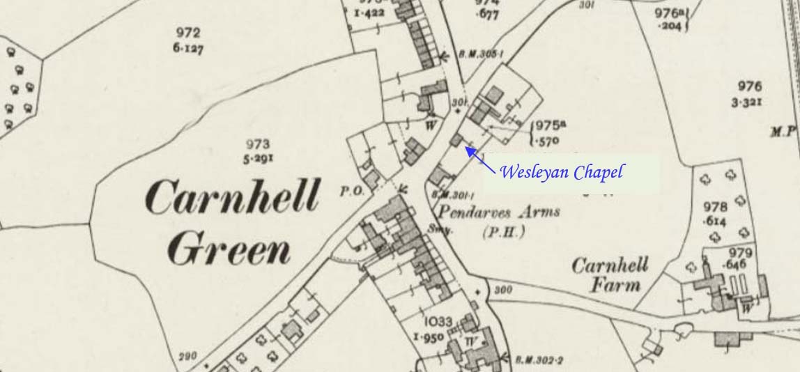
A Wesleyan Methodist chapel is recorded on the 1st and 2nd Edition 1:2500 1880 and 1907 OS Maps. The building is still extant and shown on the Mastermap as a Hall. (Cornwall Heritage Gateway)
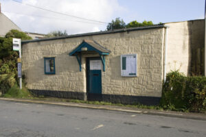
1834: Build date. (Checklist of Churches in the Hayle Circuit on the 31st August 1961)
1888: Indicated on maps.
1902: Wesleyan Chapel listed. (Kelly’s Directory)
1932: The Wesleyan, Primitive Methodist and the United Methodist Church amalgamated to become the Methodist Church of Great Britain.
1968: Closed. (Checklist of Churches in the Hayle Circuit on the 31st August 1961)
Chapel subsequently used by another denomination. (Checklist of Churches in the Hayle Circuit on the 31st August 1961)
In 2013 it was the Gwinear-Gwithian parish office.
Still standing in 2024, it is now unused.