
Mapping Methodism – Illogan Broad Lane Wesleyan ‘Ebenezer’ Chapel
Categories Mapping Methodism, Projects0 Comments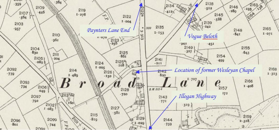
Broad Lane is a hamlet in the civil parish of Carn Brea near Illogan. This profile of Illogan Broad Lane Wesleyan ‘Ebenezer’ Chapel was compiled by Jo Lewis and Tony Mansell.
The chapel was opposite the junction of Merritts Hill and Broad Lane, but slightly set back and is marked on old maps. There is now a new housing estate there (Mill Grist Meadow).
A Wesleyan Methodist chapel at Lower Broad Lanes is recorded on the 1st and 2nd editions of the 1:2500 1880 and 1907 OS Maps. (Cornwall Heritage Gateway)
Thought to have been built in 1839, this was a daughter chapel of the Bridge/Illogan Downs/Vougebeloth Society.
Built as a Wesleyan chapel. (SWChurches)
1860: Certificate of registration, Broad Lane Wesleyan Chapel, Illogan. Certificate of registration as place of religious worship. Endorsed ‘This chapel has long been closed’, 1935. (Kresen Kernow MRR/1333)
1880 and 1888: Shown on maps. (old.maps.co.uk)
1908: Not shown on map. (old.maps.co.uk)
The premises were closed in the early 20th century. (SWChurches)